
I Walked Across Luxembourg
A hike from the west to the east of the Grand Duchy
Four weeks ago, I was feeling guilty for spending so much time inside playing Tears of the Kingdom, so I took it on myself to plan something for the National Day long weekend. That something turned out to be a hike from the westernmost point to the easternmost point in Luxembourg.
Maps and Route Planning
From the Belgian border in the west to the German border in the east is 58.1 km as the crow flies, or 100.3 km on the trails that I chose. I took four days to hike across, spending the nights in Lultzhausen, Ettelbruck and Beaufort. You can check out my route using the map below, or download a KML or GPX file.
Luxembourg has a fantastic number of marked trails, all fastidiously mapped out and available online via the government run Geoportail. The site and its datasets are administered by the Administration du Cadastre et de la Topographie, which outwardly appears to be a collection of passionate GIS nerds. Alongside the wide range of comprehensive datasets (a high resolution point cloud of the entire country, anyone?), it also offers some more whimsical facilities, like the ability to download any region in Luxembourg as a Minecraft map.
Prior to departing, I spent a morning in QGIS planning a cross-country route. The trail data from Geoportail along with an OpenStreetMap base layer made route planning as easy as connecting the dots. On the trail, I used Organic Maps, an offline mapping app for Android and iOS that uses OpenStreetMap as a data source. The app is well suited to hiking, and allows import of KML or GPX routes for display.
I’m impressed by the current state of open mapping data and GIS tools. The trails on OpenStreetMap are detailed and accurate, and Organic Maps is a pleasure to use — much better than Google Maps when you’re on foot. QGIS can be a bit clunky, but is powerful and extensible. When it came to self-hosting the map above on this blog post, I delved into some newer technologies I’d never used before, all which were well documented and easy to use:
- Geofabrik for downloading OpenStreetMap data extracts in Protocolbuffer Binary Format
- Planetiler for generating vector tiles for the region of interest encoded as a PMTiles archive.
- MapLibre GL JS, a browser based map visualisation library that supports vector tiles and GPU based rendering.
- PMTiles JavaScript library, an extension for MapLibre that uses HTTP range requests to pull down specific vector tiles from the PMTiles archive.
- OpenMapTiles styles for the map theme, encoded fonts and icons.
Equipment and Lodging
Luxembourg is a pretty easy place to hike around. There is nowhere in the country that is truly remote. Over the four day walk I never strayed further than 5 km from a village, and I was rarely without phone reception. This meant I could carry just a day pack with the bare essentials — water, snacks, toiletries and a spare change of clothes. I carried everything in a Vaude Prokyon 22 L, a terrible pack that seems to have been dropped from their product lineup. At the beginning of the hike, the fully loaded pack weighed around 7 kg.
I’m a fan of hiking in trail runners, so I wore a pair of flogged out and repaired Saucony Peregrine 8s. The weather was forecast to be warm and dry, so I chose to hike in a synthetic sports shirt and zip off hiking pants. For the times I wasn’t hiking, I carried Birkenstock Arizona sandals, jeans and a t-shirt to lounge around in.
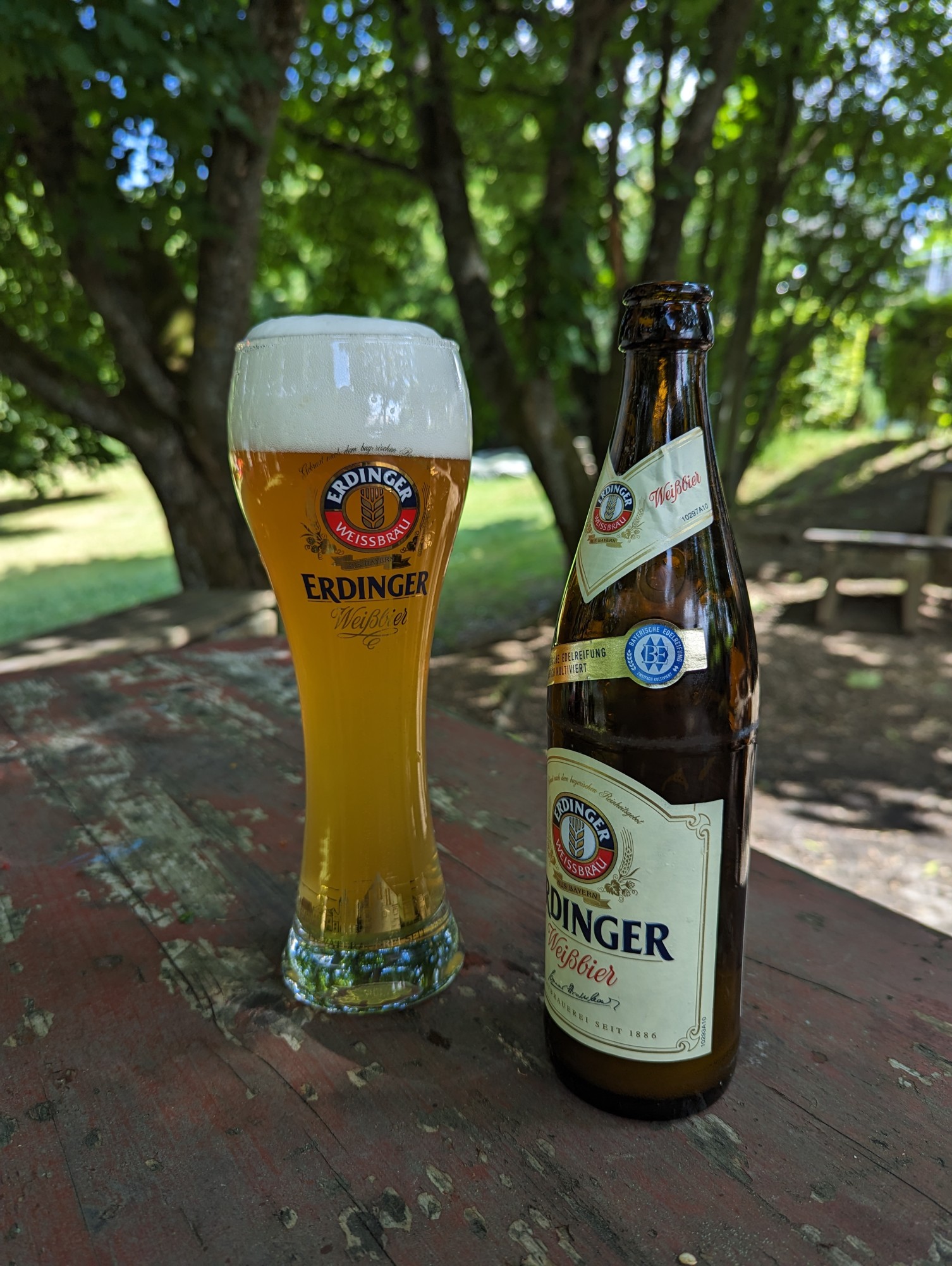
I stayed overnight in youth hostels and a hotel, and I ate at restaurants or pubs on the route. All up, food and lodging cost me around €250 for the four days. The youth hostels in particular are a great option for hikes like this. They provide a bed, clean bedding, showers, free breakfast and cheap food and beer. Unlike hotels, the common areas encourage meeting and hanging out with fellow travelers.
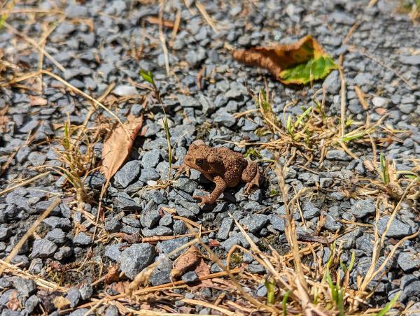
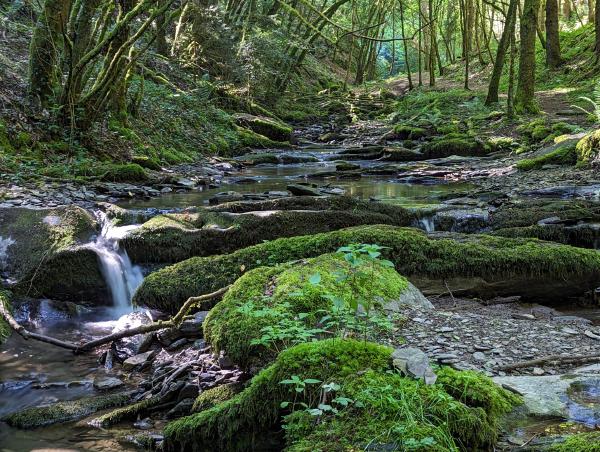
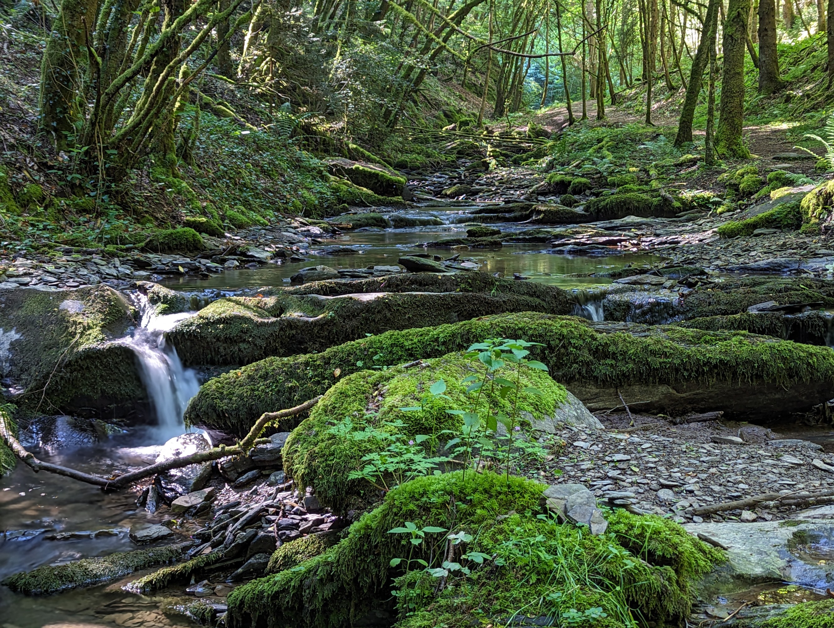
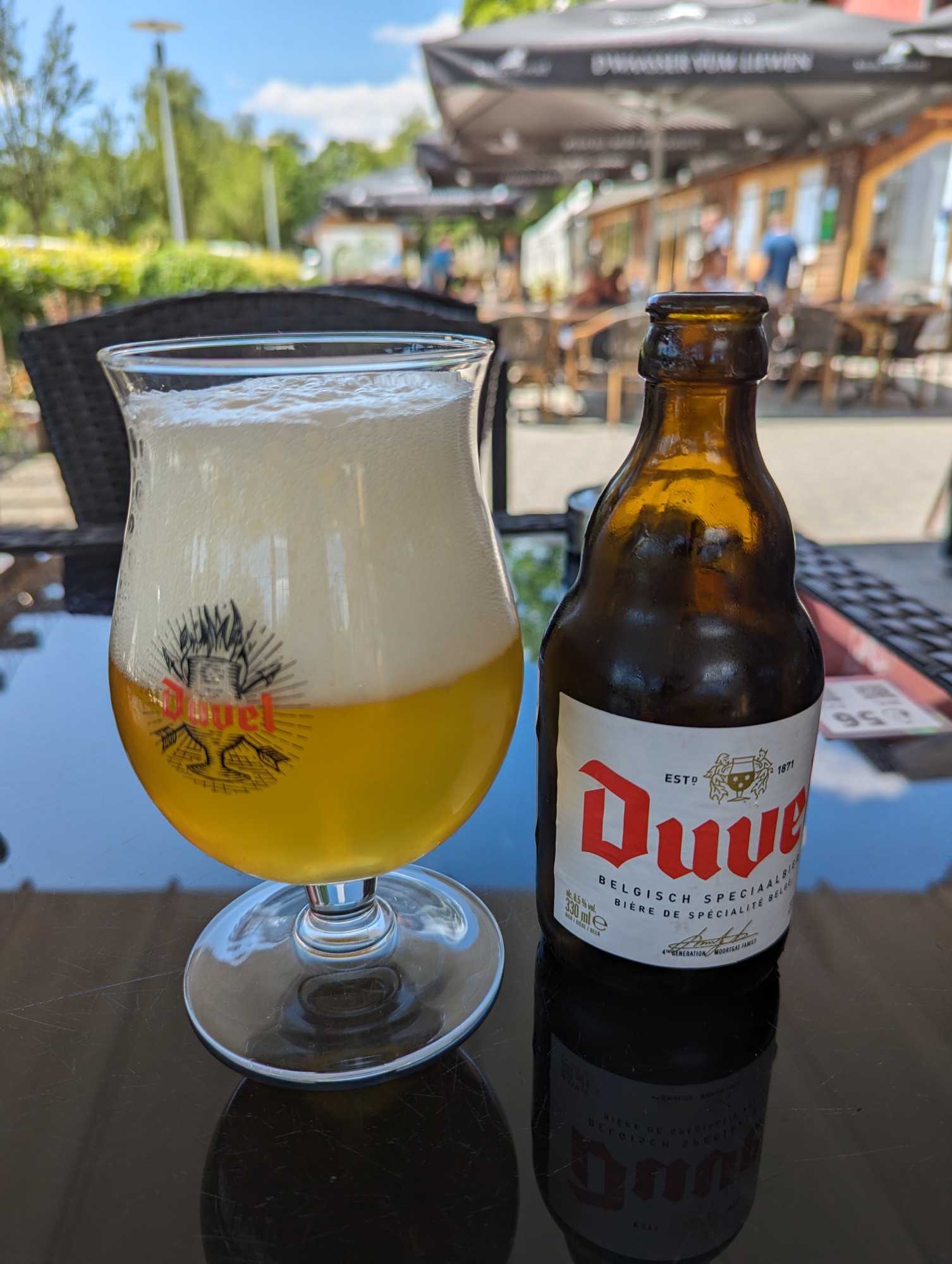
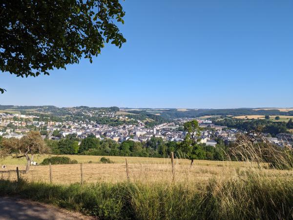
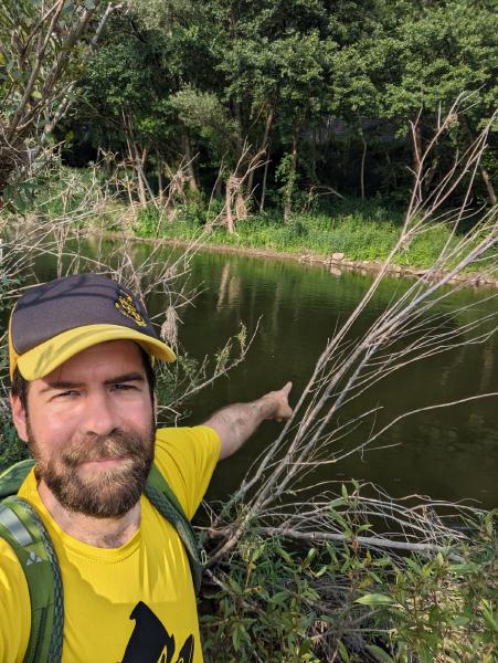
Some Photos
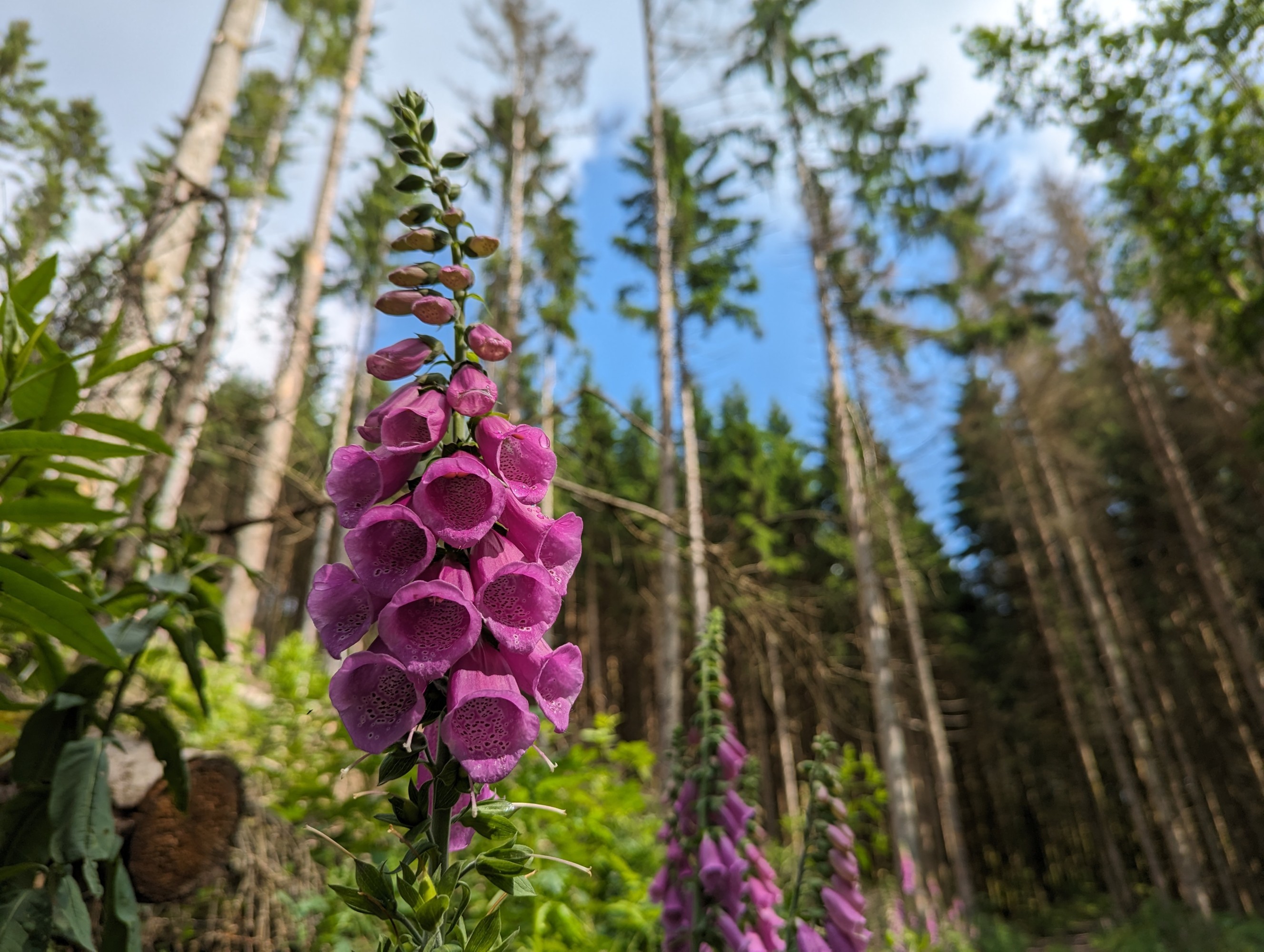
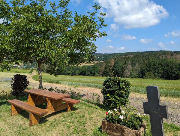
I took a bunch of photos with my phone while I was walking. Hopefully the gallery below gives a bit of a feel of the thin slice of Luxembourg my route took me through.


The Hike Itself
Day One
After breakfast on the 23rd of June, my wife drove me to the starting point of the hike just across the border in Belgium. Most of Luxembourg was nursing a hangover from the celebrations the prior evening, so it was an easy drive on mostly empty roads. I was unceremoniously dropped on a back street of Honville and started strolling toward the Luxembourgish border.
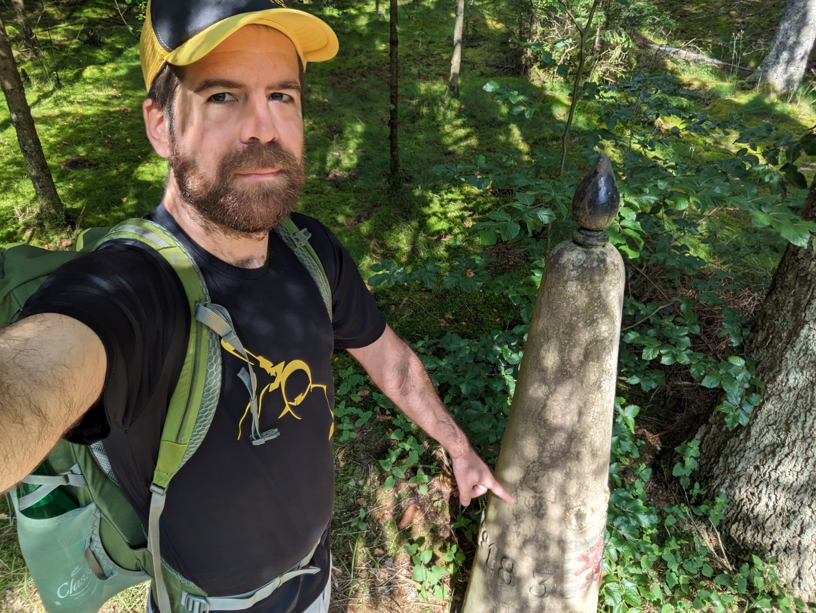
Within the first kilometer I had two unplanned stream crossings which had me second guessing whether my DIY route planning was a good idea. I soon made it to the westernmost point of Luxembourg, marked by border marker number 183 of the 507 markers that make up the Belgium-Luxembourg border, and from there began my traversal of Luxembourg.
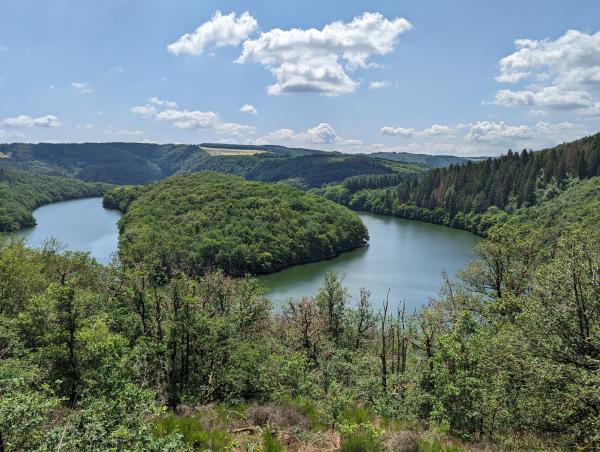
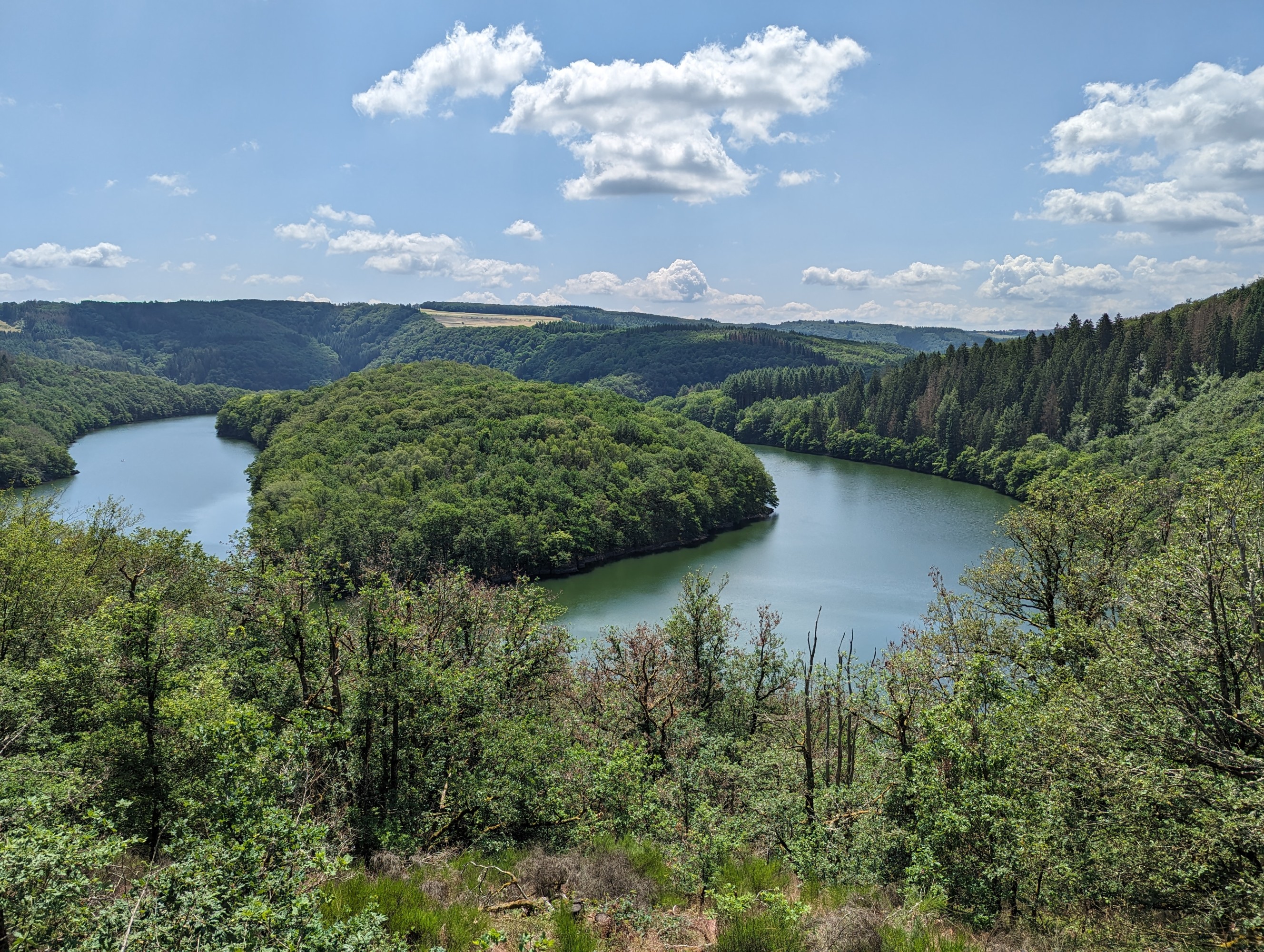
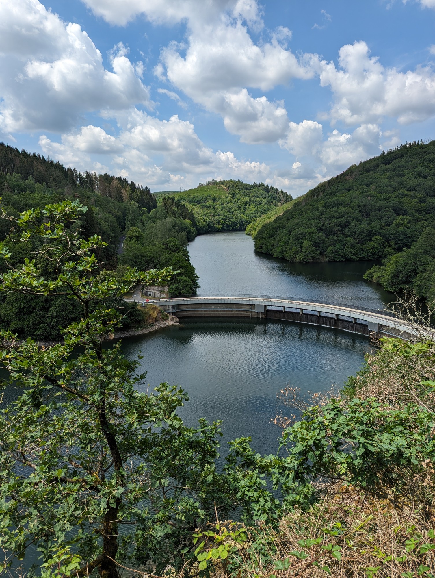
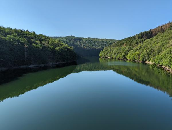
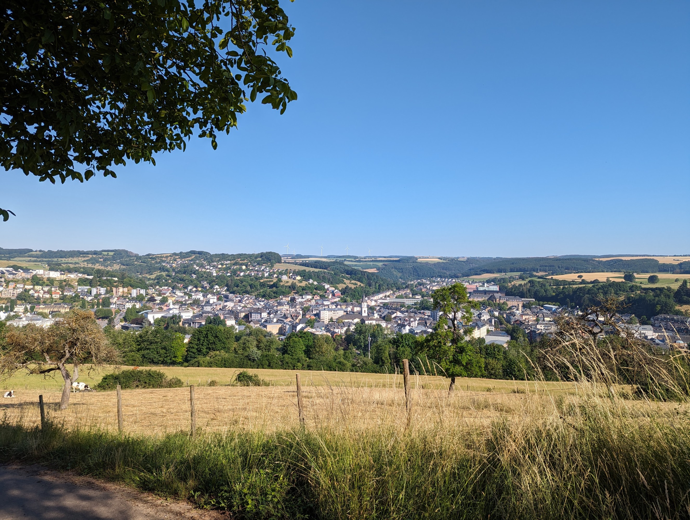
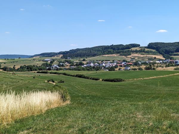
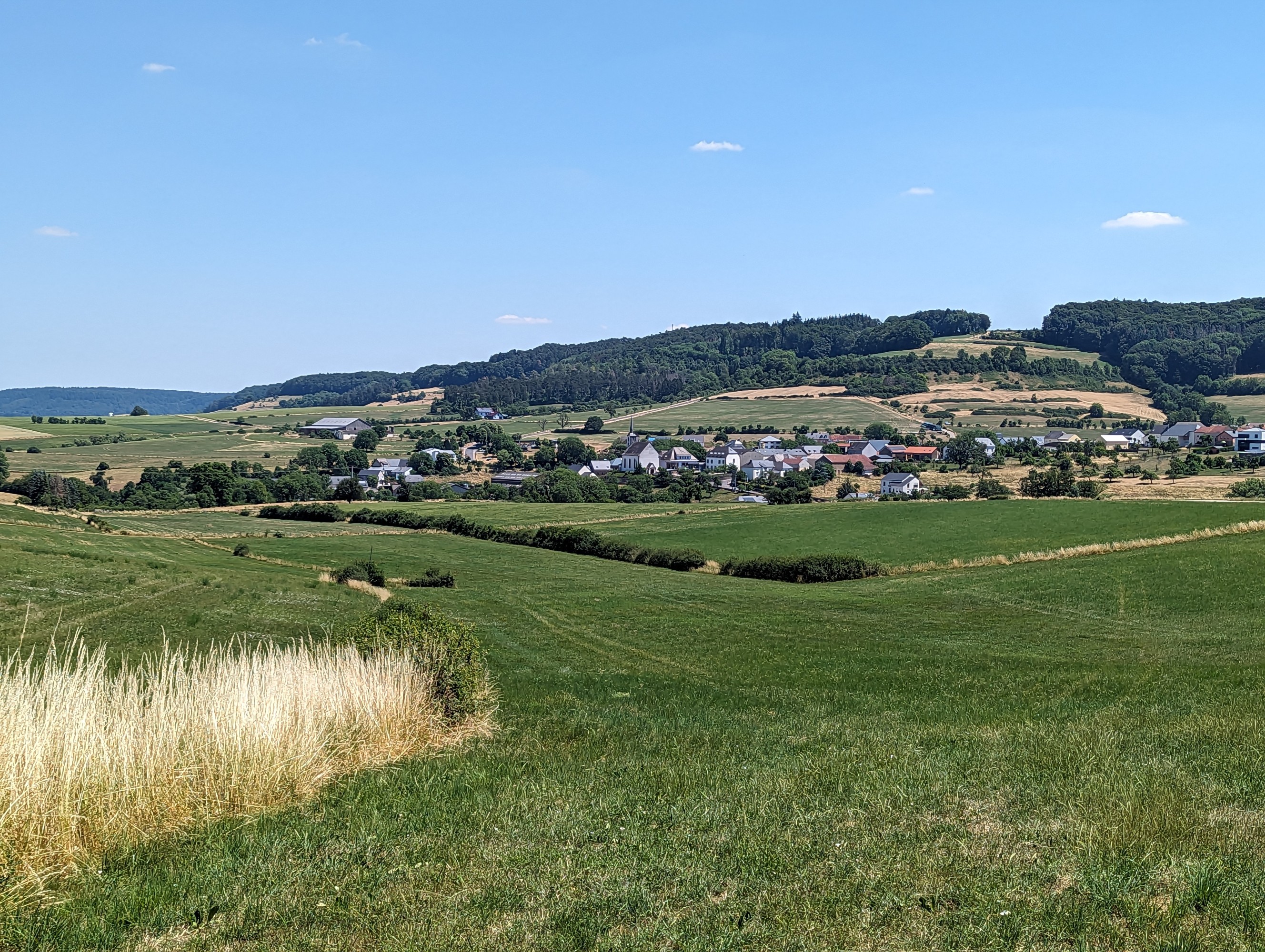
The first several kilometers of my planned route weren’t on a marked trail, so I spent a bit of time navigating. It was easy walking through rolling farmlands, small villages and timber plantations. These slowly transitioned into hilly forests forming part of Naturpark Öewersauer, the nature reserve around the Upper Sûre Lake. The first views of the lake were from a high vantage point looking down over one of the many horseshoe shaped bends in the reservoir. It was a hot day, and plenty of people were out on stand-up paddleboards, kayaks or swimming. As I got closer to the water’s edge I passed by families picnicking, groups of friends playing soccer and a few isolated fishermen relaxing with their lines in the water.
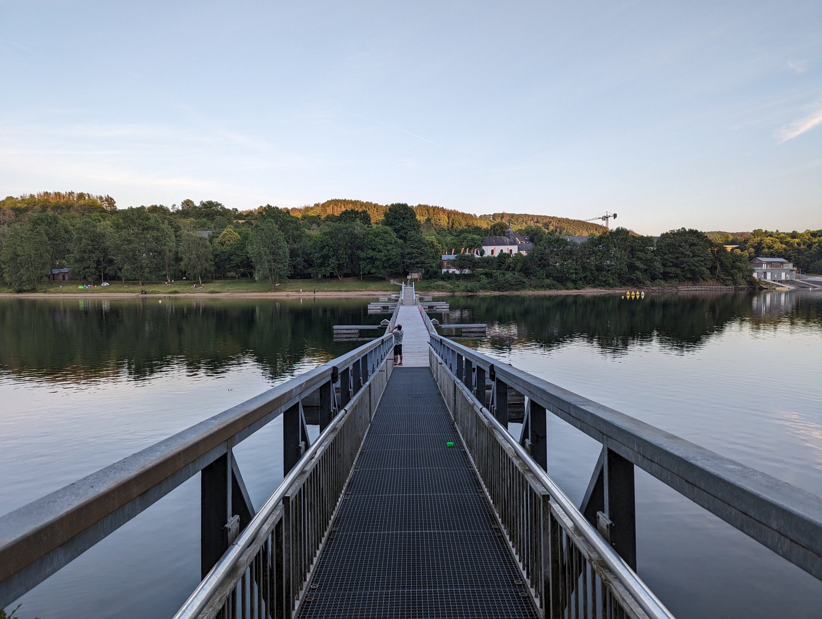
The final approach to Lultzhausen took me across a pontoon bridge and through a shady garden where I sat having a few beers while I waited to check in. I’d made good time, doing the 18 km walk in around 4 hours. I spent the rest of the afternoon napping on the foreshore and chatting with others at the hostel.
Day Two
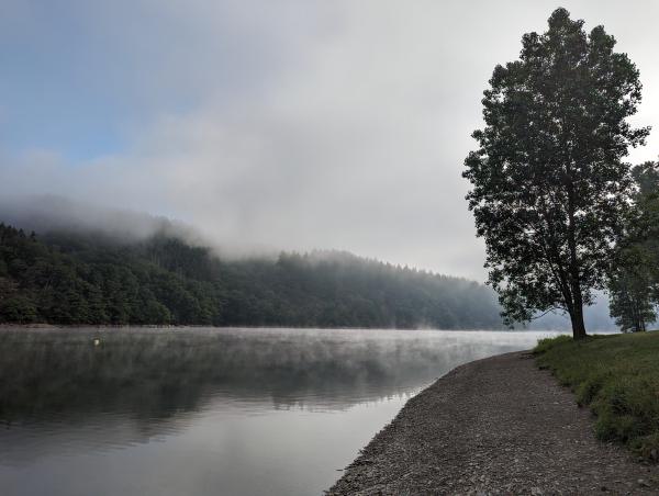
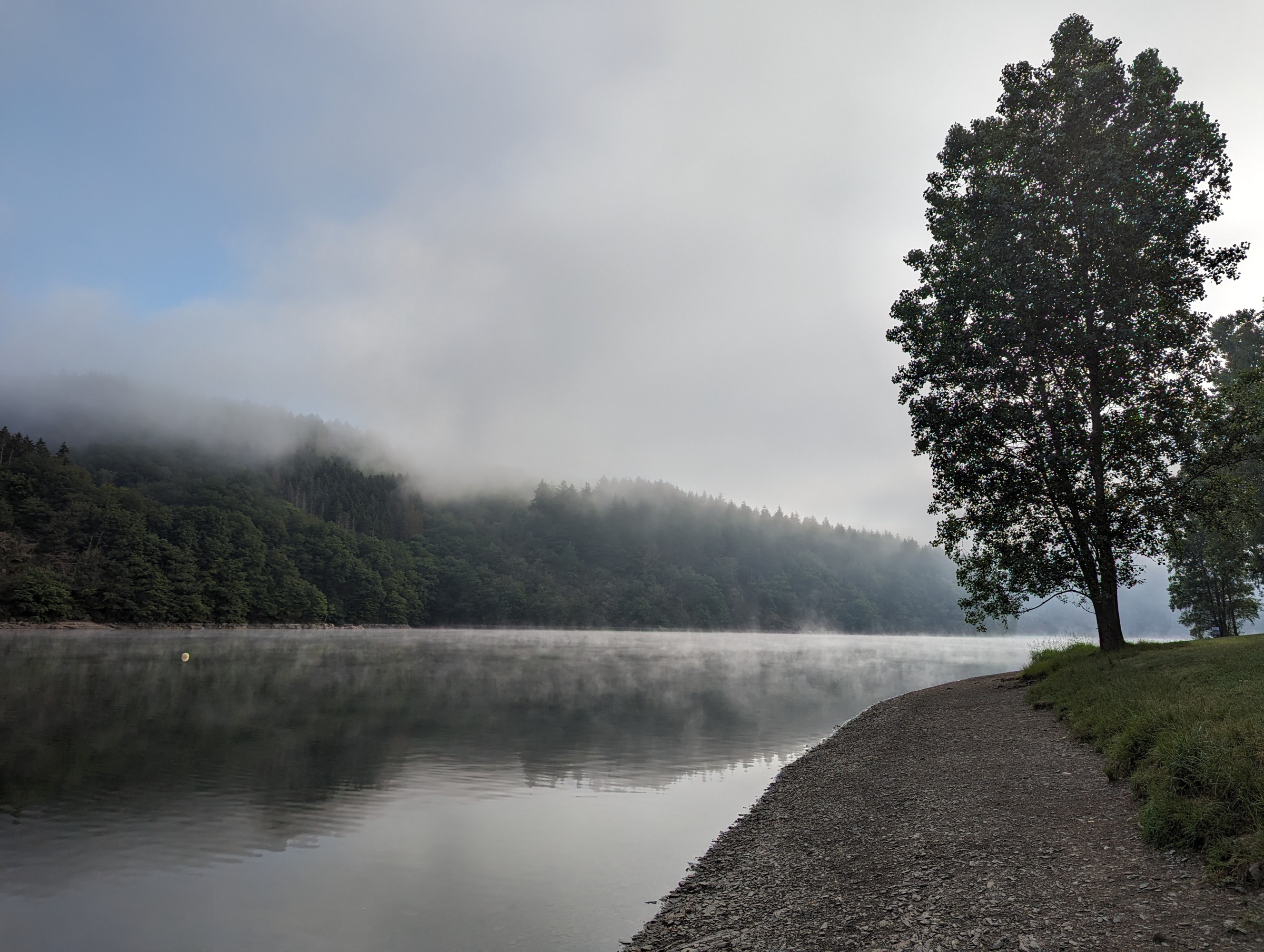
The next morning I was up early. Before breakfast, I took a short stroll down to the lake which was blanketed in fog. There were already scuba divers in the water, evidenced only by their bubbles breaking the water’s glassy surface. The second day was a 27 km hike to Ettelbruck, so I quickly ate, refilled my water bottles, checked out and was on the road by 8:30.
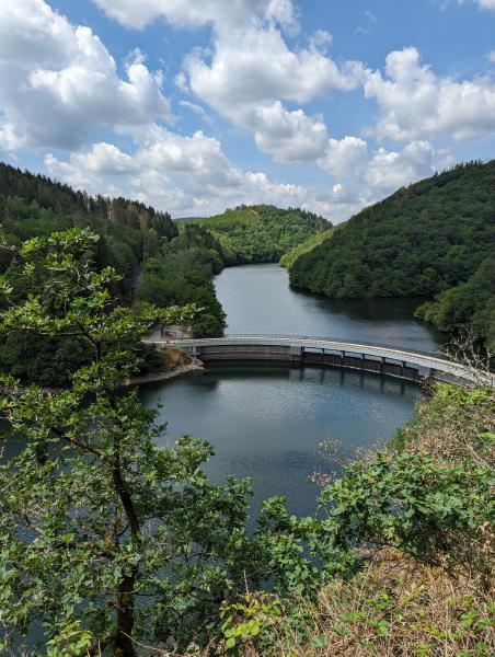
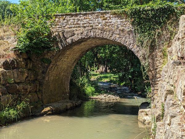
Initially, the trail hugged the edge of the lake with only one short hill climb to access a bridge and some nice views over the water. The lake narrowed into one of the streams feeding the reservoir and I followed it until I got to Eschdorf. The path coincided with the Wassersënneswee thematic trail and was dotted with artwork and areas to relax and reflect on the importance of water.
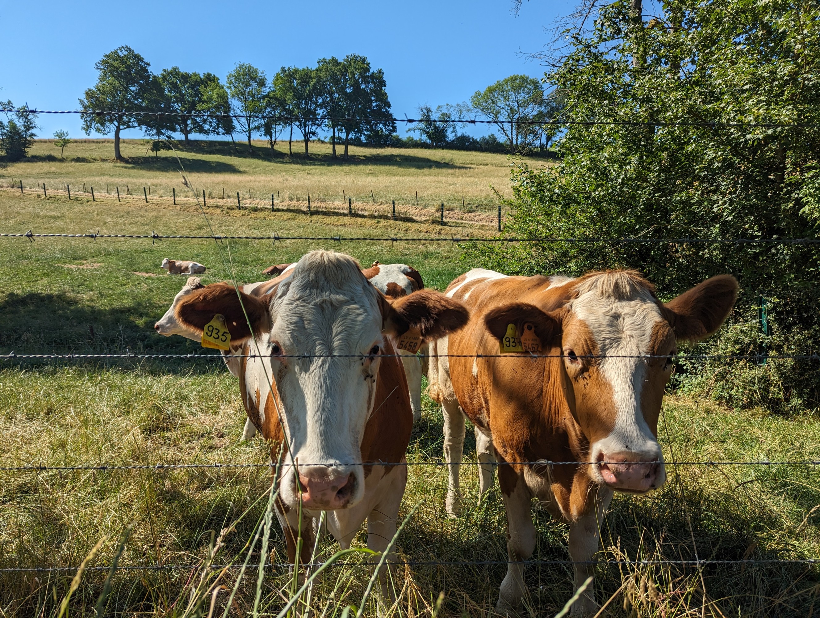
The remainder of the day took me through more quintessential Luxembourgish countryside — forests, horse stables, orchards, dairy farms and fields of wheat, corn, sunflowers and rapeseed. I stopped for a pub lunch in Fuussekaul, a town that is dominated by a sizeable campground, caravan park and activity center.
Perhaps it was the Duvel I had with lunch, the heat or the fact that my feet and knees were playing up, but I had a rough afternoon and wasn’t feeling great when I stumbled into Ettelbruck. I’d made good time, averaging over 4.5 km/h, but I realised I’d probably need to slow down a bit for the next few days, especially given the continued forecasted temperatures of 30+ °C. I found a local Chinese restaurant doing salty soups and stir fries for dinner, had a bath (I was staying at a hotel) and crashed into bed.
Day Three
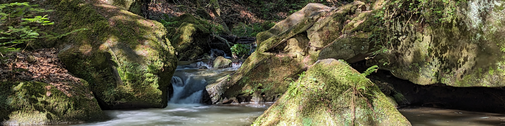
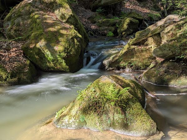
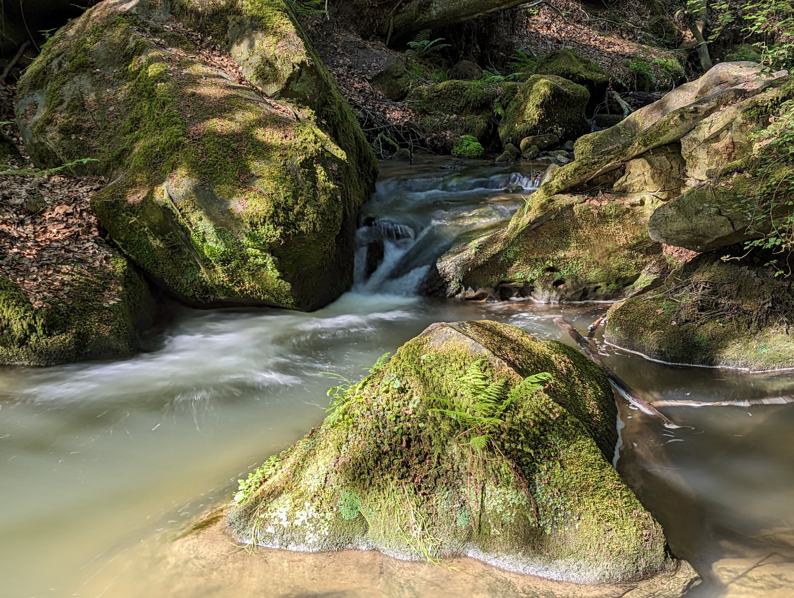
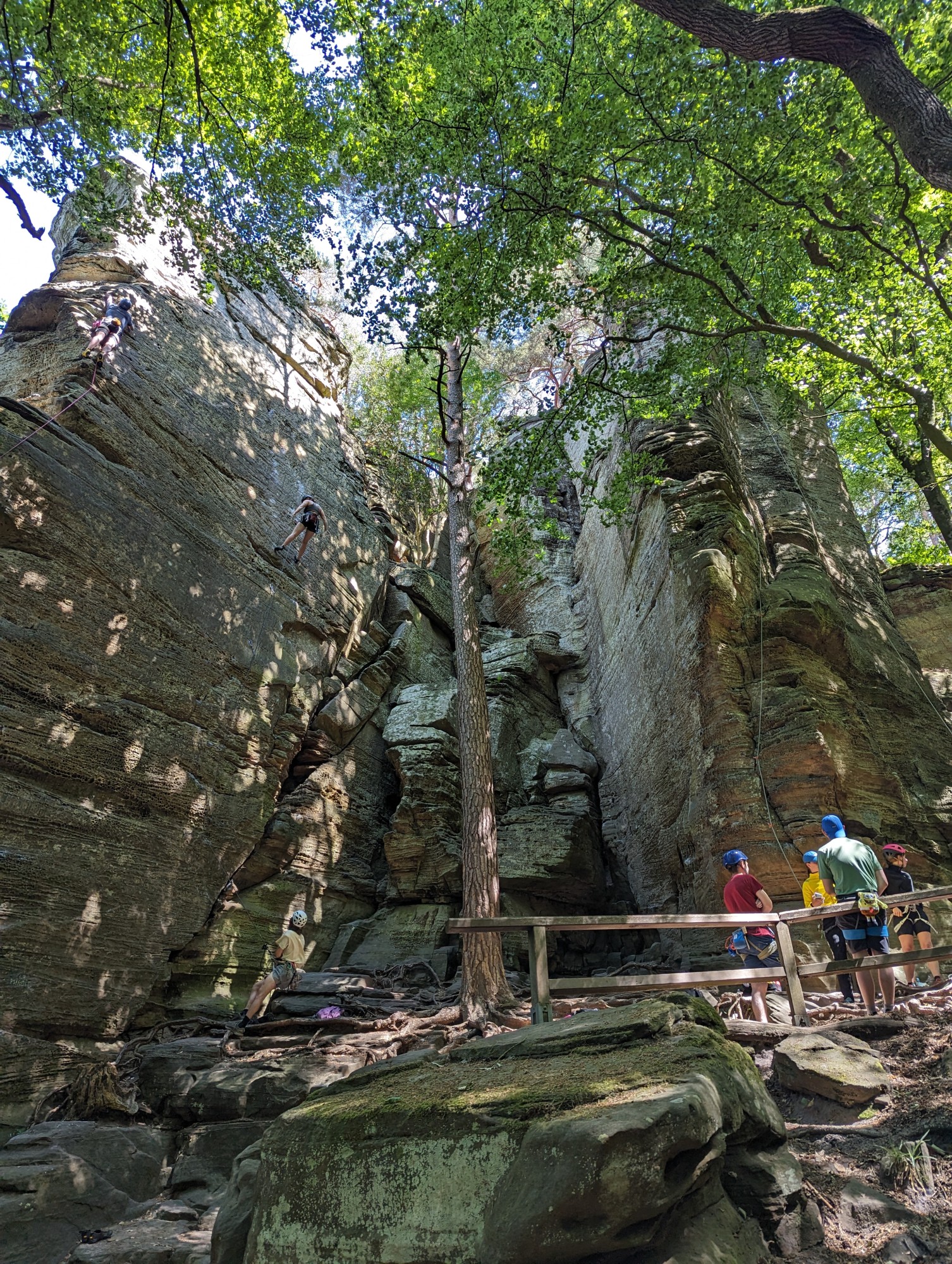
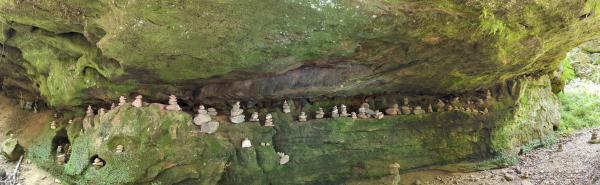
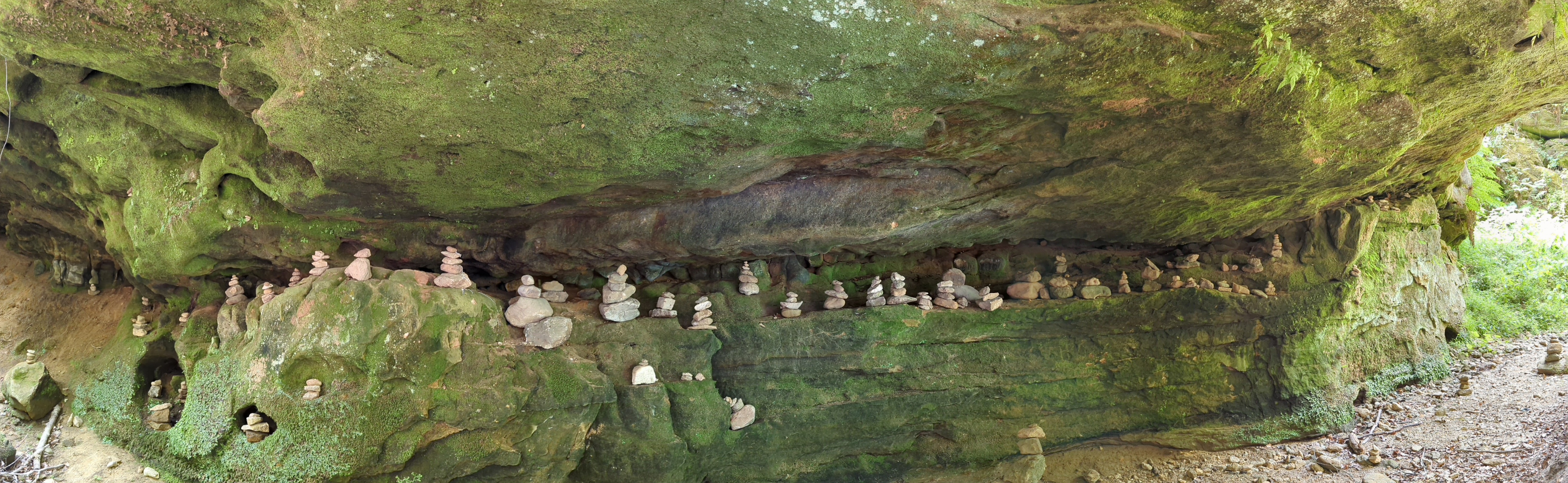
I forcibly slowed my pace on the third day. I had 24 km to walk to Beaufort over easy terrain, and the whole day to do it. I targeted around 3.5 km/h walking pace, and took short rest breaks every few kilometres. The trail went through much the same countryside as the afternoon prior. Blue skies, babbling streams, little villages and lots of farm animals defined my day as I slowly trudged along. Just before arriving at my hostel, I walked past some big, rocky outcrops heralding my arrival in the Müllerthal region of Luxembourg. It was a taste of the scenery I’d be walking through on my final day.
Day Four
Although the slower pace helped a lot, my knees and feet were not in good shape for the final day. The trail to Rosport and the eastern border included a lot of vertical — around 800 m of climbing, and around 1000 m of descent. Additionally, at 32 km, it was the farthest daily distance of the four day hike.
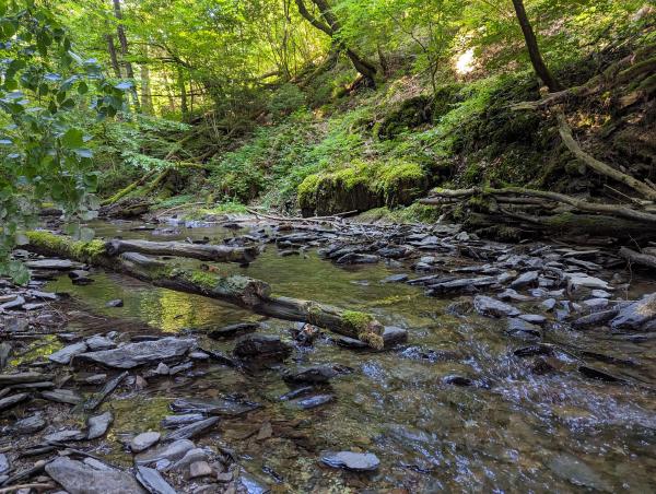
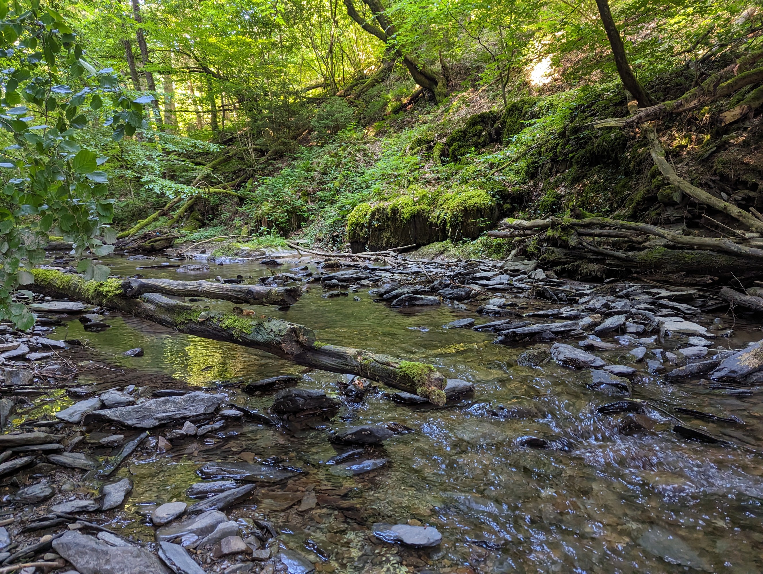
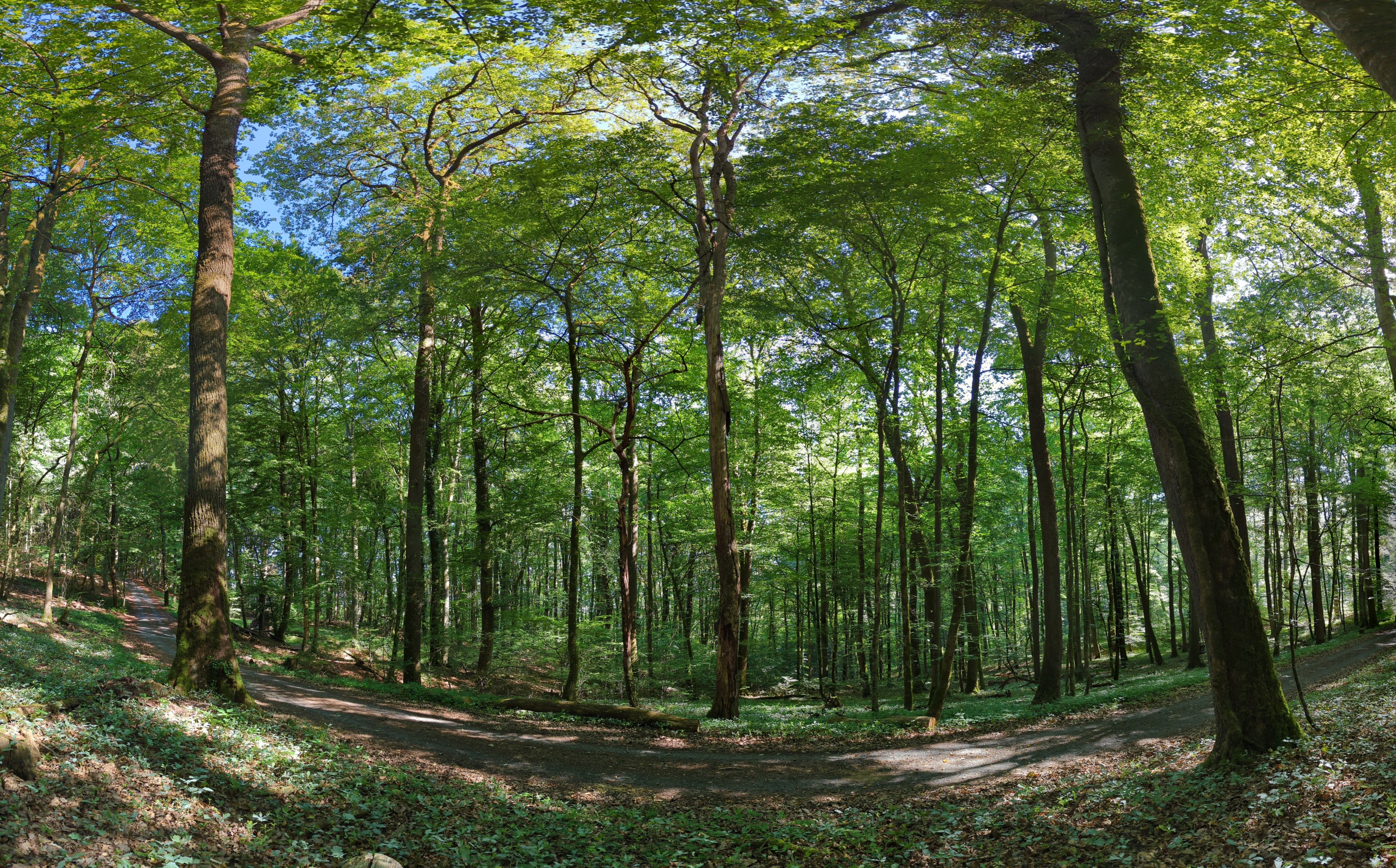
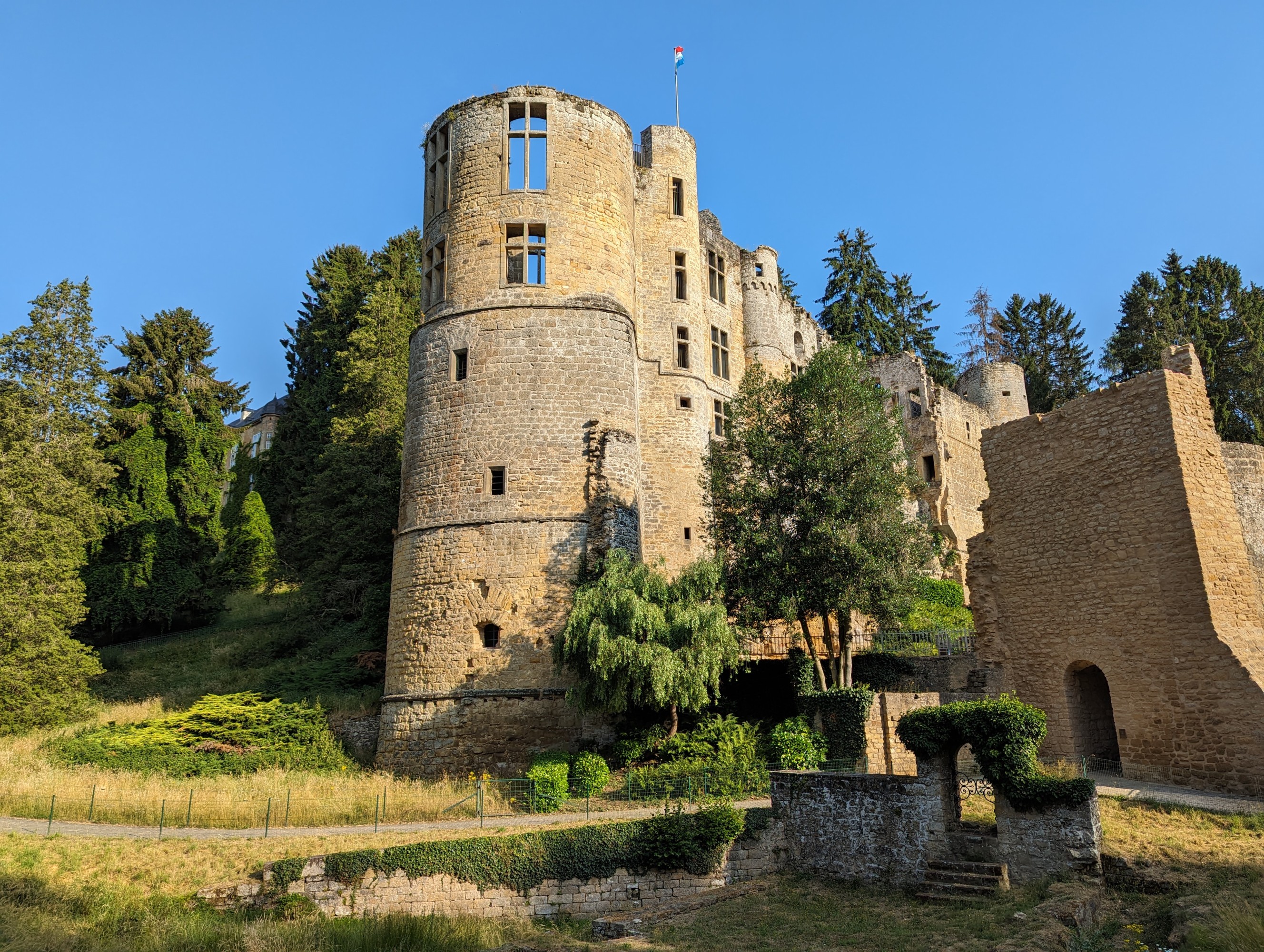
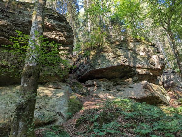
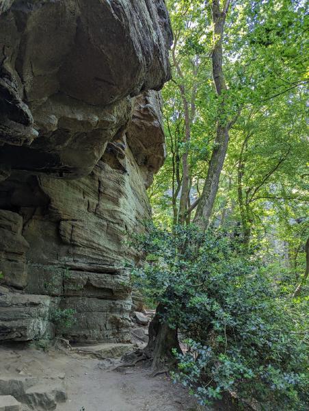
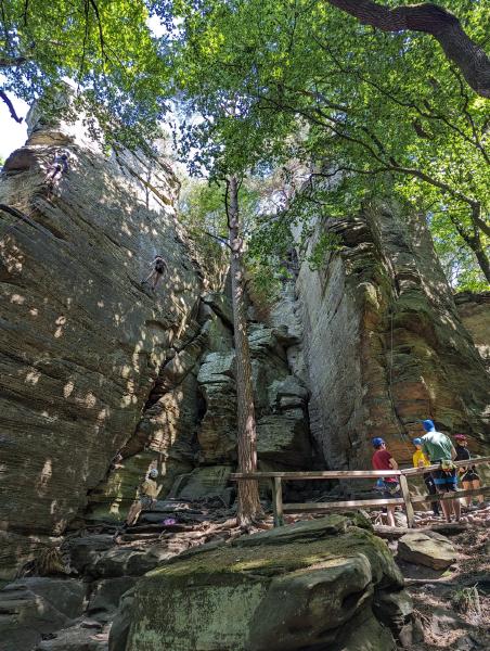
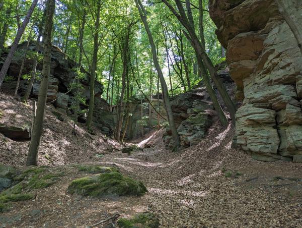
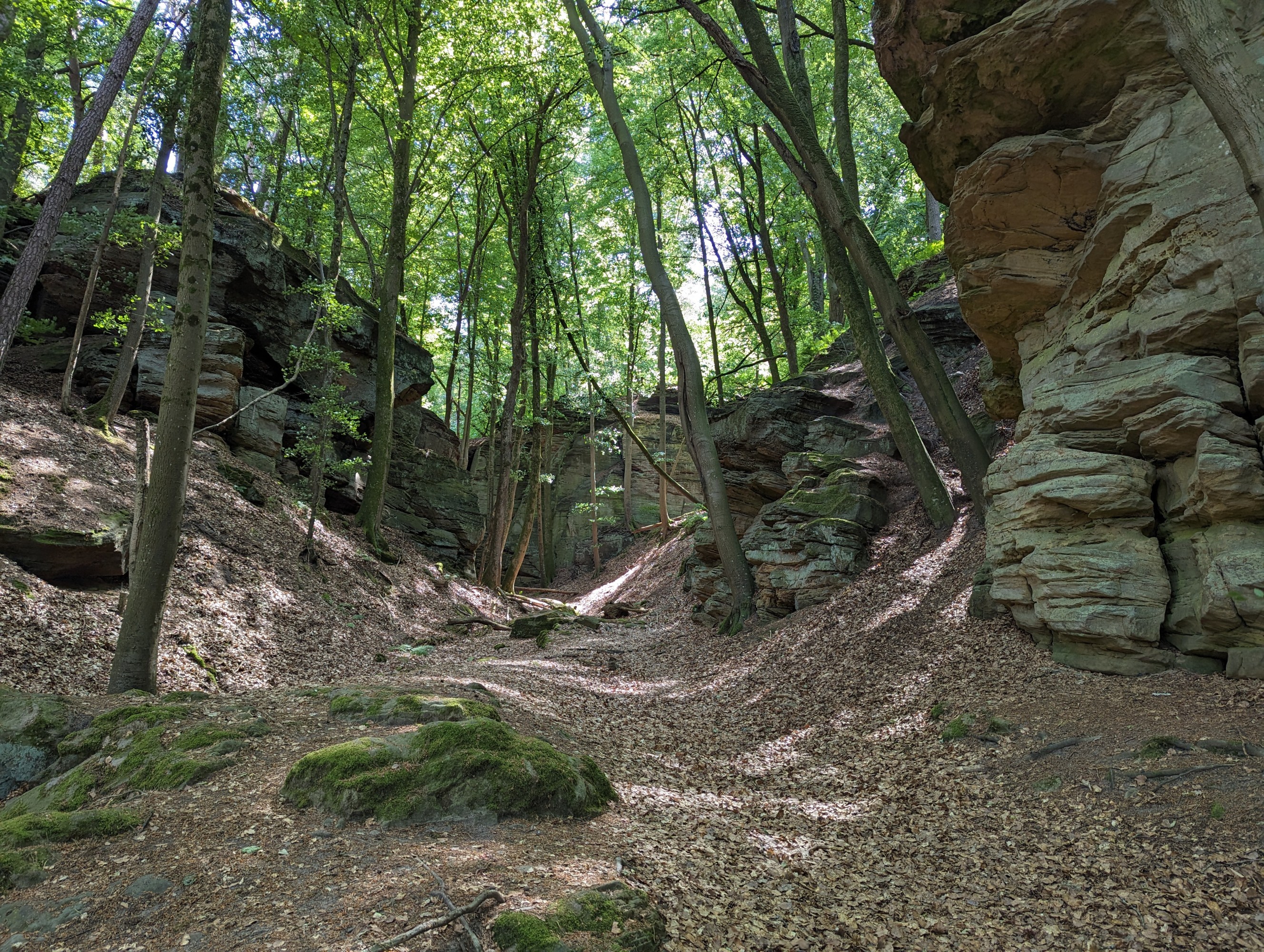
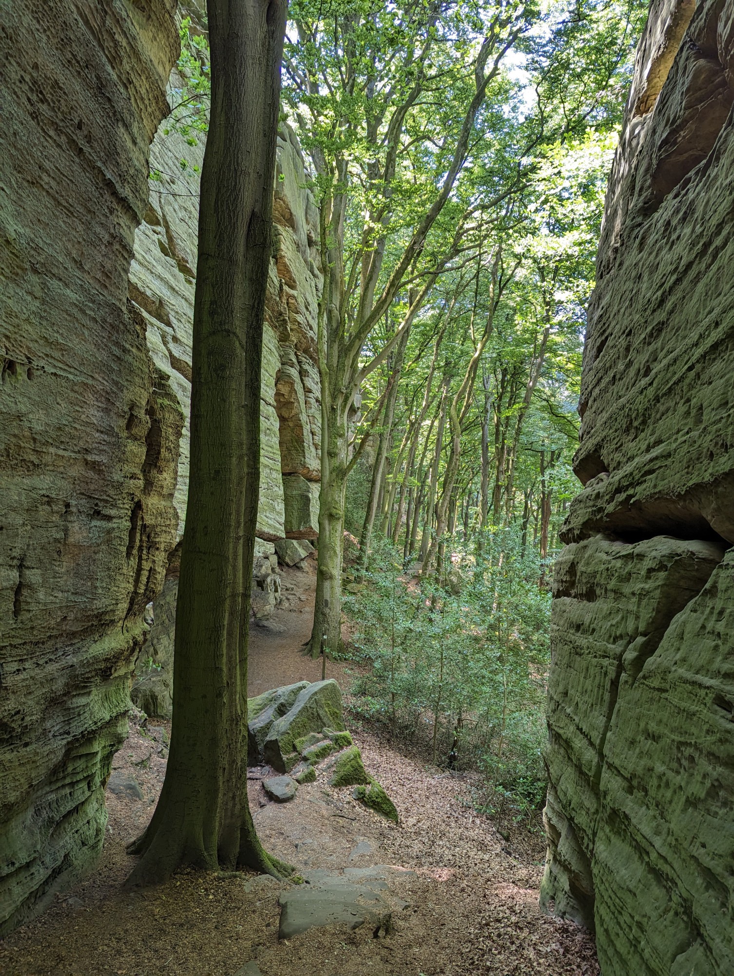
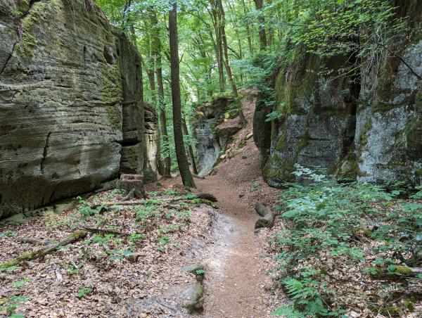
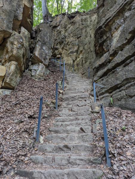
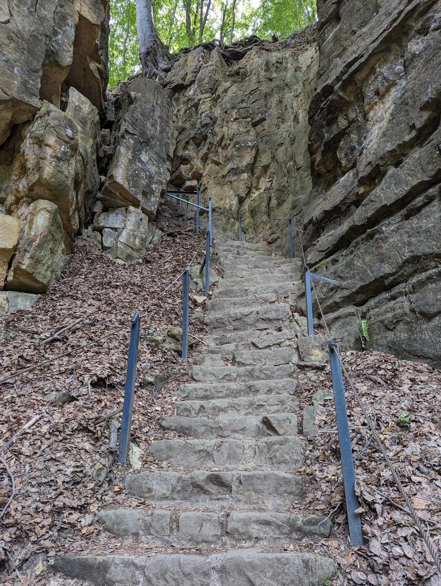
Despite hobbling along like an old man, the hiking itself was excellent. The walk down to the trailhead at Beaufort takes you past the ruins of an old castle, and you’re immediately dumped into lush, shady forest. Sheer pillars of rock or small creeks bound one, or sometimes both sides of the path. The climbs are well prepared with steps and guide rails that take you up to fantastic views of the surrounding countryside.
I walked for around 7 hours through the Müllerthal landscapes until I arrived at the riverside town of Echternach. Switching my shoes for sandals and meandering along the sprawling foreshore was a welcome break from the ups and downs, but it didn’t last long. The final push out to Rosport was on lesser traversed trails and required clambering over fallen trees and squeezing through rocks that had recently broken away from the main formation.
At about the time I arrived in Rosport, my wife started the drive out to pick me up, giving me around 50 minutes to get to the eastern border and back to the pickup point. The easternmost point in Luxembourg isn’t really intended to be a destination. It’s marked on Google Maps with a few amusing reviews, but it’s actually located on a swampy floodplain at the bottom of a hill. The hill itself is farmland, with wheat and corn crops, grape vines, and plenty of barbed wire fences and scrubby windbreaks to scramble over. Once you’re down on the floodplain, you need to bush-bash through head-high reeds and nettle thickets to get to the Sûre river, which is the border between Luxembourg and Germany.
For me, it was mostly about completing the journey. I made it down to the water’s edge, took a few photos and headed back toward Rosport. I met up with my wife 11 hours after I started that morning, and I was suffering. My feet and knees were properly shot, but we drove across the border into Germany for dinner and then headed home so I could shower and sleep.
Reflections
This hike was a great little adventure. I got to see some beautiful places and filled out a long weekend plodding along trails and letting my mind wander. It was more difficult than I expected, and I’ve learned to pace myself and concentrate more on my footwork, especially when descending. There are minor things I would tweak (like taking trekking poles), but all in all it was a great success.